Agriculture
Agricultural Field Intelligence
Scouting notes, photos, satellite and weather layers become field-level observations — AI suggests where to look, agronomists decide what it means.
Product thesis
An agronomist advising thirty farms holds an extraordinary amount of knowledge in the worst possible places: notebooks, photo rolls, message threads, and memory. Satellite imagery and weather data exist in separate tools that don’t know what the agronomist saw on the ground last Tuesday. The concept is a field-level system of record: every observation — a scouting note, a photo of leaf damage, a vegetation-index anomaly, a frost event — anchored to a field boundary and a date, building a history that outlives any one season or notebook.
Who it serves
- Independent agronomists and advisory teams covering dozens of farms
- Cooperative advisory services that need consistent records across advisors
- Farm managers who receive recommendations and want the evidence behind them
The connectivity reality
Rural coverage is not a footnote; it is the operating environment. The mobile app is offline-first without qualification: field boundaries, recent observations, and imagery tiles for the week’s planned fields are pre-fetched while on a farmhouse network, and every capture works with zero signal. Sync is opportunistic and conflict-tolerant — observations are append-only facts, so two devices syncing late merge cleanly rather than fighting. A tool that fails at the field edge gets deleted by June.
Layers into observations
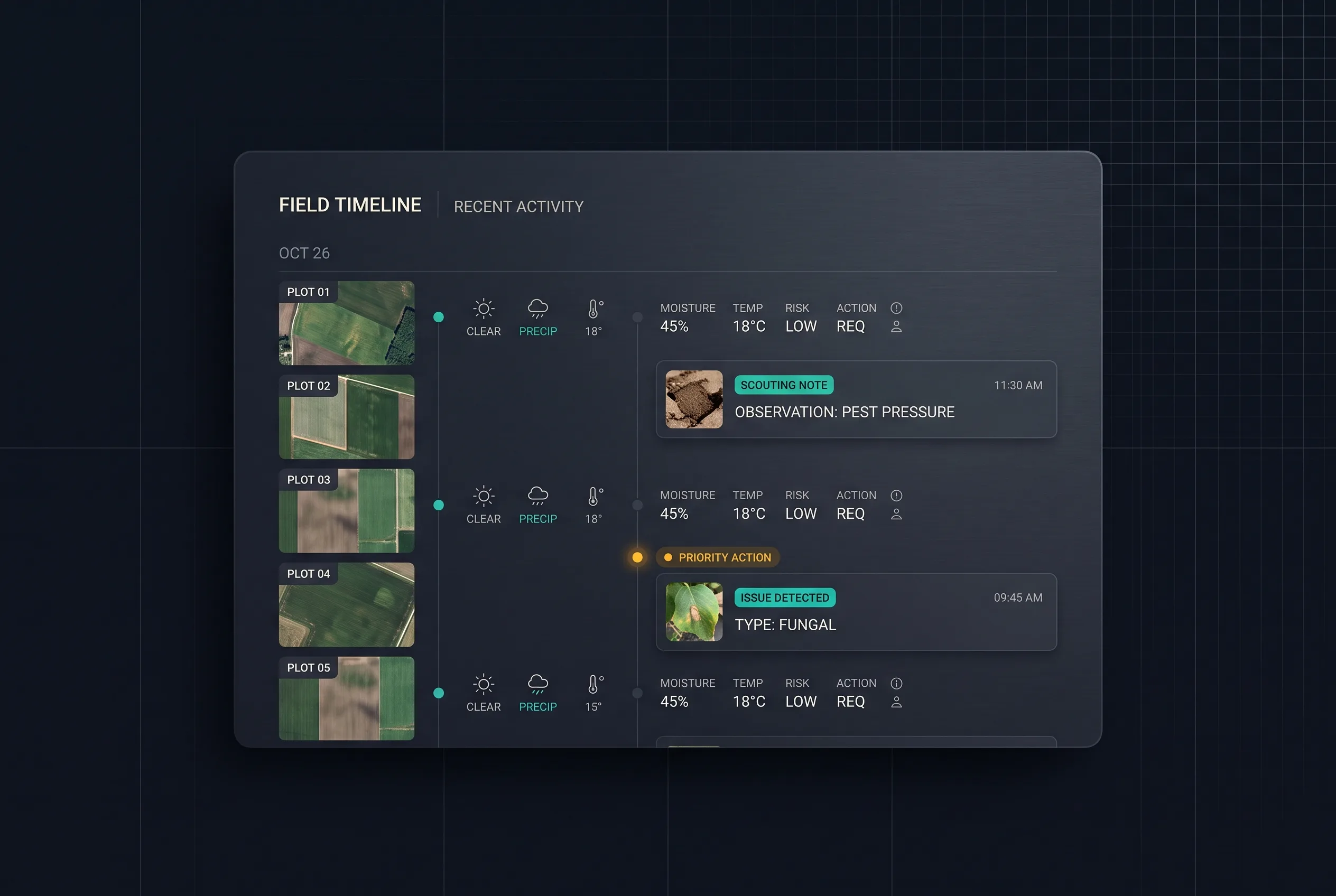
Satellite indices and weather histories are context, not conclusions. The product’s job is to lay them under the human record: a vegetation-index dip becomes interesting when it sits next to last week’s scouting photo of the same corner. Each field carries one timeline where machine layers and human observations interleave, and every entry keeps its provenance — measured, observed, or inferred.
Where AI fits — and where judgment rules
AI does one job: it suggests scouting priorities. From index changes, weather patterns, and crop stage, it proposes which fields deserve boots first this week — and every suggestion carries its reasons, in agronomic terms, so it can be argued with. That is the boundary. The system never diagnoses from a photo alone, never generates spray or treatment recommendations, and never messages a farmer autonomously. Agronomy is judgment exercised on the ground, with liability attached; the product’s stance is that AI ranks where to look, and the person who walked the field decides what it means.
Core journey
- Plan the week AI-ranked scouting priorities, with reasons
- Drive out fields, history, imagery cached offline
- Scout and capture notes, photos, geo-anchored, no signal needed
- Judgment call agronomist assesses and records findings
- Back in coverage append-only sync, clean merges
- Advise the farmer recommendation with its evidence trail
A seasonal business
The customer’s revenue, attention, and tolerance for new tools all follow the crop calendar. That shapes the product economics: onboarding must fit the quiet window before the season; the tool must prove itself within a single season, because renewal decisions happen in winter; and pricing should follow advised hectares, not seats, so a practice that grows pays more and a small one isn’t priced out. The compounding asset is the multi-year field history — season two is when the record starts answering “what did this corner do last year?”
Prototype scope
One crop family, one region’s imagery and weather sources, the offline capture loop, the field timeline, and the priority-ranking layer with visible reasoning. The behavioral hypothesis to test: will an agronomist capture observations in the app during the field walk rather than reconstructing them in the evening — the same habit battle every field tool must win.
Evaluation and open questions
- Capture-in-field rate versus evening batch entry, observed across a season slice
- Priority usefulness: share of AI-suggested fields the agronomist agrees deserved the visit (target hypothesis: clear majority, with disagreements logged and reviewed)
- Sync integrity: zero lost observations across forced-offline test scenarios
- Open: imagery licensing costs at small-practice scale; whether cooperative advisory services need multi-advisor record ownership rules the concept hasn’t yet designed